Dallas Outdoor Rock Climbing Report: The Plano Pyramids

Finding good, outdoor rock climbing in Texas is hard. There’s Mineral Wells. There’s Paradise on the Brazos. There’s Ham Creek Park where Jim Day and his posse brave poison ivy and crumbling limestone to map out new routes on chossy rock. But where can you climb after a day at the office in Dallas? I thought I might have found the answer in the Plano Pyramids.

The Plano Pyramids are forgotten climbing spot popular in the 80s. They are railroad trestles of a century-old railway that connected Dallas to Sherwood Shores on the Red River, the boundary with Oklahoma. As the tracks approach Dallas, they go right along 75. Rotting and overgrown, they are not maintained, but the treated timber persists, and in the shady woods, some of the railroad ties are impressively intact and still leaking tar. Somewhere in those woods, the tracks went over a bridge, and the trestles purportedly offered some climbing challenges. I had to find them and see for myself.

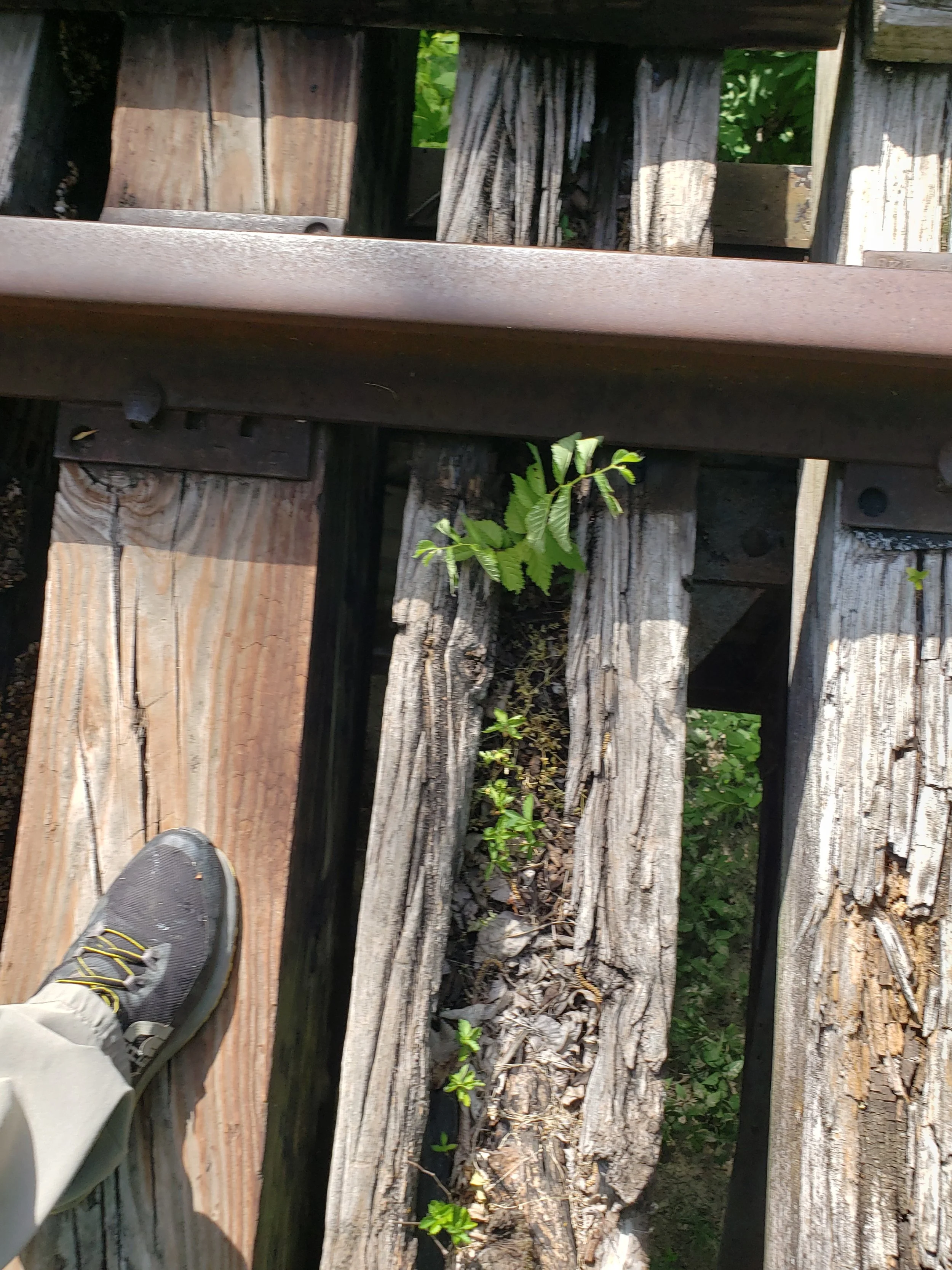
It took me much quality time with Google Maps satellite images and two attempts to find them. To get to them, you park by misnamed “Courses at Watters Creek” golf driving range (there is no Watters Creek in the area) and follow the bike path under 75. Once on the other side of the highway, you continue until you come to a scenic tunnel. The railroad tracks go right over the tunnel, so climb the embankment and head south (to the right). Just when you start to get used to the hike along the tracks in the lush, shady foliage, you find yourself walking twenty and then thirty feet above the ground as the tracks pop out over Rowlett Creek. It was a very pretty view, but I had to be mindful to stay on the ties as the spacing between them plunged 30 feet to the creek below. Additionally, the fallen crowns of tall trees have fallen on the tracks, necessitating simultaneous weaving between these additional obstacles.

Once I crossed to the other side, I took assessment of the situation, and climbed down the side of each trestle, one on either side of the creek. To my dismay, the walls of the trestles had been freshly coated in graffiti, some of which was not PG. Every inch, it seemed, was covered in paint. Once the paint dries completely, however, there are some distinct climbing possibilities. One could use the tracks above as a toprope anchor, and there are some challenging but doable routes. Still, I’d prefer not to climb on what will inevitably become dried paint, which has the smell that reminds me of old highschool classrooms. One of the things that love about climbing Texas limestone in Mineral Wells and Paradise on the Brazos is the way my hands and arms smell of oak and lichen afterwards. I’d rather they not smell of eau de locker room.

As it became time to leave, I, mildly enthusiastic about the find, did a small climb up an easy route. (I had on only running shoes) I had to throw my left forearm over the ledge, press it into the ground and hoist myself the rest of the way. The pebbles on the ground dug into my arm. On the ledge above me a wall of poison ivy oozed its silent menace onto ledge I had just climbed. Was it my imagination, or did my arm feel funny? No matter, I might get a little something, but I grew up in Virginia where getting a little poison ivy in the summer was to be expected. I never reacted much to it—I usually could get through fields of poison ivy with minimal harm.

Well, this was different. Despite showering when I got home, in three days I was an itchy mess. The open sores of poison ivy are not contagious; it is actually the invisible poison ivy oil which is difficult to remove that spreads the reaction. It slowly spread down my body although it diluted as it did so, so the rashes on my abdomen and legs were not as bad as my arm. Unfortunately, I spread it to my wife. She reacted to it secondhand much worse than I did firsthand, needing to slather on anti-itch creams for a couple weeks.

So….do I recommend the Plano Pyramids? I do, actually, as it’s a lovely forest oasis in an urban wasteland. But between the poison ivy and the paint smell, I give it two thumbs down for climbing. But maybe you need to see for yourself….

Climbing Texas Heat

One thing I perversely love about Texas is its extremes. Growing up in Virginia, we always seemed to have bland weather….the summers were hot but not THAT hot, the winters were usually cloudy and raining instead of snowing. Which brings me to climbing in Texas in 2022. On July 8th, Texas Wild West held a lead climbing course starting in Hico and ending near Blum. Despite the heat, it was awesome! Our previous course/trip had been in Mineral Wells in January with the starting temperature being 17 oF and February, when the park authorities closed the rocks to climbing due to ice. This July 8th, the temperature hit 108 oF. What did our party of six do, and how?

Climbing class cancelled in February due to ice. We took a hike instead.

Icicles beside Lake Mineral Wells.

We started off in downtown Hico with veteran climber David Bradley giving us an overview of lead climbing. Listening to him is somewhat of a history lesson as it gives you an appreciation of how relatively new specialized rock climbing gear is; a Chicagoland native, Dave learned to climb before dynamic ropes were invented and through the iterative improvements (and some dis-improvements) made to carabiners and pro gear. We listened to his groundschool at the base of his 60-foot, 100-year-old silos, fitted externally with handholds all along the height, and then practiced lead climbing knots, quickdraw clipping, and anchor tieoffs. We really appreciated the shade cast by tarps Dave had hung; otherwise the sun beat down from above and reflected off the concrete base below us. Still it was morning, so the temperatures were still in the (high) double digits.

Groundschool on an concrete slab that reflected the heat. We were happy for the tarps that gave us shade.

Aftwards, for fun and giggles we made a brief tour and climb of Dave’s (air conditioned) bouldering gym in the interior of one of the silos and then drove over to the Nolan River, crossing the Brazos River and enjoying the Texas landscape from our air-conditioned vehicles. Once in position at Nolan River, we all were issued electrolyte packs to ensure proper hydration and hiked a half mile in the blistering sun down into and along the Nolan River canyon. We enjoyed the fossils at the Jazzercise boulder and made some other fossil discoveries around the Chuck Norris boulder, finally arriving at Choss City. There we lead climbed and top-roped the route, which was challenging but not overly so for beginners. It had been fitted out with chains, which made it all the more appropriate for beginners for lead climbing. Poison ivy was present on location but avoidable. While hot, the climbing site was shady in the afternoon making for some enjoyable climbing.

There was sunburn. There were flappers (ripped skin on the hands). There were falls. There was dark urine afterwards. And most of all, there was sweat. But was it worth it? Totally. No one wanted to leave. Come on out—with proper caution, hydration, and camaraderie, Texas triple digits are more fun than anything you could do indoors!


Bowhunting East Texas

Finally, I saw him. The perfect buck. There he was, in the corner of my eye, ten yards to the side of me. He had his head down and was trying to slink out of sight, but the sharp angles of generous pair of symmetrical antlers, at least eight points, rendered his efforts comical. Still, I dared not look at him directly for fear of spooking him. I was almost certain where he was headed, following a worn deer trail around an island of brush and then across the fence onto the Big Lake Bottom Wildlife Management Area where he would be instantly legal to shoot. He disappeared around the island. The wind rose, rattling the late autumn leaves into a gentle roar. I took advantage of the sound to move closer to where the game trail met the fence. I positioned myself and the bow at the ready and waited.

It had taken me five days of hunting Big Lake Bottom to reach this climax. I first started on the western side of the WMA, where a large peninsula juts south into the Trinity River. First I had to drive an ATV 30 minutes over a grassy track filled with mud holes and sections that had to be detoured. The ATV track ended at the river. Leaving my helmet and heavy ATV emergency bag with the ATV, I continued on foot. Unlike most of my bowhunting brethren, I refuse to use a tree stand. Humans are both hunters and designed to move. I stalk game. The first day, I walked about five miles before I saw my quarry, or rather, their white tails bounding away in mild alarm. As I walked I learned the lay of the land and the domains of its denizens. The mature forest of oak, hickory, hackberry, and other hardwoods is interspersed with grassy glades and thick swaths of oatgrass, cactus, and thorns. These latter dense thickets nevertheless have game trails running through them that, as indicated by the low height of the overhanging branches, are made and maintained by hogs.

Above: Mature hackberry trees recognizable by their corky, striated bark.

Deer, on the other hand, prefer the easier walking through grassy forest glades although the optimal areas for them were grassy clearings interspersed by thicket patches against which they can camouflage and which they can use as visual barriers between an oncoming predator. Namely me. Nevertheless, I appreciated the easier walking that deer habitat provided compared to that of the hogs.

Classic hog habitat; note the dense oatgrass around the saw palmetto.

I was encouraged to learn also during my long afternoon trek in that these deer were fallible. In addition to shunning thick cover, the deer could not move silently in the grassy areas either, since the plethora of fallen limbs, sticks, and natural forest litter snapped under their feet as well as my own. In one case, I stalked a deer that I spotted bounding away toward a thicket. As I quietly followed in the direction of the last sighting, which led between two thickets, a twig snapped across the thicket to my right. I turned to spot my quarry across the thicket. It had tried to circle behind the thicket around to my back, but the same crackling twigs that gave me away now gave it away. Before I could draw my bow, however, it had bounded away.

As evening fell, I followed the banks of the Trinity back. At one point, I scared up a large doe at close range as she climbed up the steep banks of the river, almost running into me at the top. She took off immediately before I could get off a shot.

Bend in the Trinity River

Hiking back through a dark forest filled with fallen tree trunks, eye-level spiderwebs and spiders, and hog underbrush was difficult enough, but the darkness enhanced by cloudy skies and a failing flashlight battery made for an even more suspenseful trip. So when an owl boomed close by, my adrenaline jumped and I had to remind myself that while I was only 5 miles from the George Beto Penitentiary with nothing but a bow and arrows, any escaped inmates were surely having as difficult a time in the woods as I.

The next morning, I returned to the area where I had begun my trek. I moved slowly through the forest glade until I was sure there were no deer. After a half hour of waiting and slow movement, I assessed it was safe to start hiking briskly. With my first purposeful stride, a pair of white tails bounded through the thickets. Deer in their chosen habitat have an incredible way of blending in. Taking a page from their own playbook, I crossed the clearing and waited. I scanned the empty glade before me and put up my binoculars for good measure. My astonished eyes found the shape of a young doe otherwise perfectly blending in to the forest floor moving not twenty yards in front of me. Like her colleague the day before, she was circling around behind my former last spot in order to resume her grazing itinerary. We spotted each other simultaneously, but she kept her steady pace. In desperation, I fired a shot in front of her to cause her to slow down. It worked, and startled, she turned to look at me directly to see how far I was. However, deer, being a prey species, have eyes on the sides of their heads rather than in the front, as we do. As such, she had to back down and lower her head awkwardly in order to view me with both eyes. Even then, I could tell it was a strain for her to focus. However, once she had gotten her distance from me, she bounded along confidently on her chosen path. Foolishly, I loosed a second arrow on her while she was in flight only to watch her look back one last time before vanishing into the brush.

After a few more hours, I returned to the ATV and switched over to explore the east side of the WMA.

Here the thickets were not as thick; one could see (and be seen) much further in the woods. I scouted this area over the next couple days, following the uneven contours of the WMA boundary. There were essentially two main attractions. First, the area where the land dropped off suddenly into the massive Trinity River, was full of game. On my initial approach, two deer dashed across the grassy track. When I attempted to stalk, I could not find them in the open woodlands, but the largest cottontail rabbit I have ever seen, the size of a small dog, scared me half to death as it exploded out from near my foot into the forest. There was a doe that I caught sight of a number of times, but she was too wary for me to get close enough for a shot. The ultimate high, however, was when I was admiring how plainly colored songbirds blended in perfectly with the forest floor, given away only by their movement, when I saw out of the corner of my eye three massive wild hogs trotting away from me single file, their small hooves soundlessly bearing their massive bulk. I gave steady chase and encountered them again near the River’s edge at about thirty yards, but the thickets and distance between did not provide a good shot. Had I a rifle rather than a bow, it would have been a different story.

Hog tracks by Trinity River.

The second attraction on the east side was an overgrown field not cultivated for a long time. It was a bulge of the WMA on the map and away from the river; however, it was very difficult to get to. A stream cut it off from the rest of the WMA, and my first day scouting it out I had to cross fallen logs with a full pack and a bow and arrow ten feet above the water. Once across, the pasture was ideal for deer, and in a particular spot on the boundary, I came across a shed antler. At that spot I looked up to see forty yards away a doe catching my scent on the wind. She immediately bounded over the boundary fence and ran into the WMA. Just on the other side of the WMA boundary was a game feeder. I had found a good place for an ambush. I scouted the whole field that day and found two more shed antlers, but nowhere was quite as tantalizing as the deer feeder on private property with the game trail running over the fence onto the WMA. Clearly, the feeder and the line into the safety of the WMA was the highlight of the area.

Hunter taking nap

Taking a nap after finding the perfect ambush spot.

The last day of the hunt, which happened to be my birthday, I laid the ambush. The weather changed in the night from a low in the 50s to the lows in the 30s. Up into the cold and on the ATV at 5:30 am. At the creek before the field at 5:45, finding my way through the predawn woods. Because of the pitch black, I did not feel safe crossing the creek on a high, unstable tree trunk. There was nothing but to ford the stream on foot. The first step into the water sank up to midcalf in mud. “Black gumbo mud” is the local moniker for this perilous muck that can suck your boot off if you’re not careful. The center of the channel afforded more stable footing, but the mud cliff of the opposite side yielded no purchase for my boots, so I had to support my body weight by forcing my fingers into the mud bank and alternately climbing and pushing my bow and arrows before me until I reached the top.

Dawn rose clear and cold. I slowly traversed the field of chest-high grass and reeds until I came to the grassy track near the feeder. This time I approached from downwind, treading cautiously until the feeder came into sight. Nothing was there. As I continued down the grassy track, I then spotted him, the birthday buck. Taking up position following the wind gust, I waited. Long minutes passed. But sure enough, I spotted him fifteen yards in front of me. His head was low down, calf height, but somehow he’d gotten it through the fence in that position. He was eyeing me with a single eye (since, remember, deer can’t really look with both eyes) with the greatest suspicion, hoping I wouldn’t see him so low down. This was my chance. I began drawing back my bowstring. It was surprisingly difficult because my muscles were so cold. And then, tragedy. In mid draw, my arrow fell off the arrowrest on the side of the bow. I looked down to guide it back on with my finger. The buck saw me break eye contact and bolted through the fence to the other side of the grassy track completely within the WMA. Then he paused to look at back at me in a perfect “quartering” shot with his heart and lungs exposed. His expression was almost disdainful. Had I successfully drawn back my bowstring during the time that he passed through the fence, I would have had the perfect shot. As it was, I began the process of drawing the bowstring back from the beginning, but as I did so, the birthday buck skipped away into the brush.

Of course, I tried to follow and track him down in the overgrown meadow, but all to no avail. The cold, crisp, still morning gave way to a cloudy, cold, and windy day. After a couple hours, I ceased my hunt, forded the creek, and began my journey home, ATV to truck, truck to home. I had to tell my family and friends that I didn’t get our deer this year, but that it had still been worth it. I had tested my mettle against that of a wild creature designed for escape and brushed repeatedly close to success. I had confidence that I was skilled enough to force an audience with an unwilling monarch of the hidden forest and that very likely next time it would be I who won at an encounter. And perhaps most of all, the peace of the forest I had so patiently hunted now lay in my heart like still waters.

Rock Climbing Lessons Applied to the Workplace

I’m fairly new to rock climbing. That may be surprising because my two other careers are outdoor adventure guiding and information technology. (A note on the latter—physically active geeks tend to try rock climbing at some point, and some of my colleagues are really good.) But as I learn the basics of climbing, I notice some cross-disciplinary lessons that are applicable to most careers.

The first lesson is: lean in. When you’re climbing a wall, thrust your pelvis against the rock. This will keep your center of gravity closer to the wall, so your hands and feet do not have to work as hard to keep you on. The further away your center of gravity is from the wall, the easier it is to become off balance, and the more your grip strength will have to compensate for the added load.

In the same way, you need to lean into your profession. You need to read the daily news in your industry. You need to go to conferences, know who the people are, and be known by them. That way you can understand the changes in the landscape. Just like griping the wall, it will be easier to persist in times of adversity and to adapt to changes in the industry.

The next rock climbing lesson is a mantra familiar to rock climbers everywhere: keep moving. Your muscles quickly tire in a static position, even as you are searching for the best route forward. It is usually better to quickly find a hold and keep moving rather than search for a better hold. Many times on real rock there are no good holds; but a poor hold that you can stick to for a short time can be a bridge to…another poor hold that you can stick to until you reach the next one or a perhaps even a blissful good hold.

In a professional career, keep moving. Movement takes different forms. It could be new positions within the company or in a new company, new skills acquired, or new initiatives you formulate and drive forward. Recently I joined my IT company’s mentorship program as a mentor; not a great foothold into management but a bridge to something else that might lead to something else that might lead me into management. As it turned out, my mentee was an accomplished program manager on our French team. Quite possibly outranking me, she is now an ally I can rely on in the future.

When climbing, I tend to be eager out the gate and pay attention to what’s at eye-level and above. But legs are stronger than arms, and when I neglect my footholds the attention they need, I’m in for a world of hurt. Those cool dynamic leaps only work from a stable footing, and even simpler upward movement requires a solid foundation. Focus on the footwork is the lesson. Foot placement is usually more important than handholds.

Similarly, make sure you lay the foundation for your next career move. The flashy elevator speech or projection of presence at a critical time are important, but they need to be backed by solid credentials, education, and experience. In information security, for instance, everyone wants to be a hacker, but only those who code AND get the certifications are truly recognized as such. Make sure you have good footholds before launching for the next level.

The final rock climbing lesson: grit. You know it when you feel it. This weekend I was climbing a route that had stumped my climbing partner. Fifteen feet up, the rock wall bulged. There was a foothold at the base of the bulge but no foothold or handhold for another ten feet up. I made it where my partner had failed, but I’m not sure how. I remember that I was determined and even more that I felt uncomfortable as I operated outside my comfort window. As I made my way over the bulge, the thought crossed my mind, “never again”—but of course we always do it again. When I got down, we talked about how rock climbing shoe rubber makes it possible to smear your foot on the rough surface of the stone and stick long enough to keep upward movement. But on reflection, success has even more to do with grit. Rock climbing is one of those sports where determination translates visibility into concrete progress.

Grit’s needed in the workplace too. The determination to go on—even and especially when you’re operating outside your comfort zone, outside of what’s acceptable behavior, outside of the traditional work ethic. It’s especially important as an entrepreneur in my outdoor adventure guiding business, where I feel like I am at once and the same carving out a niche where none exists and generating demand for that niche. Who wants to be outside in Texas heat? You do, and I’m here to tell you why. Even better, come out with me, and I’ll show you the ropes.

My climbing partner reaching the top of The Nose at Purgatory Hollow, Mineral Wells State Park.

My climbing partner reaching the top of The Nose at Purgatory Hollow, Mineral Wells State Park.

Trail Rides and Dino Tracks, Spring 2021!

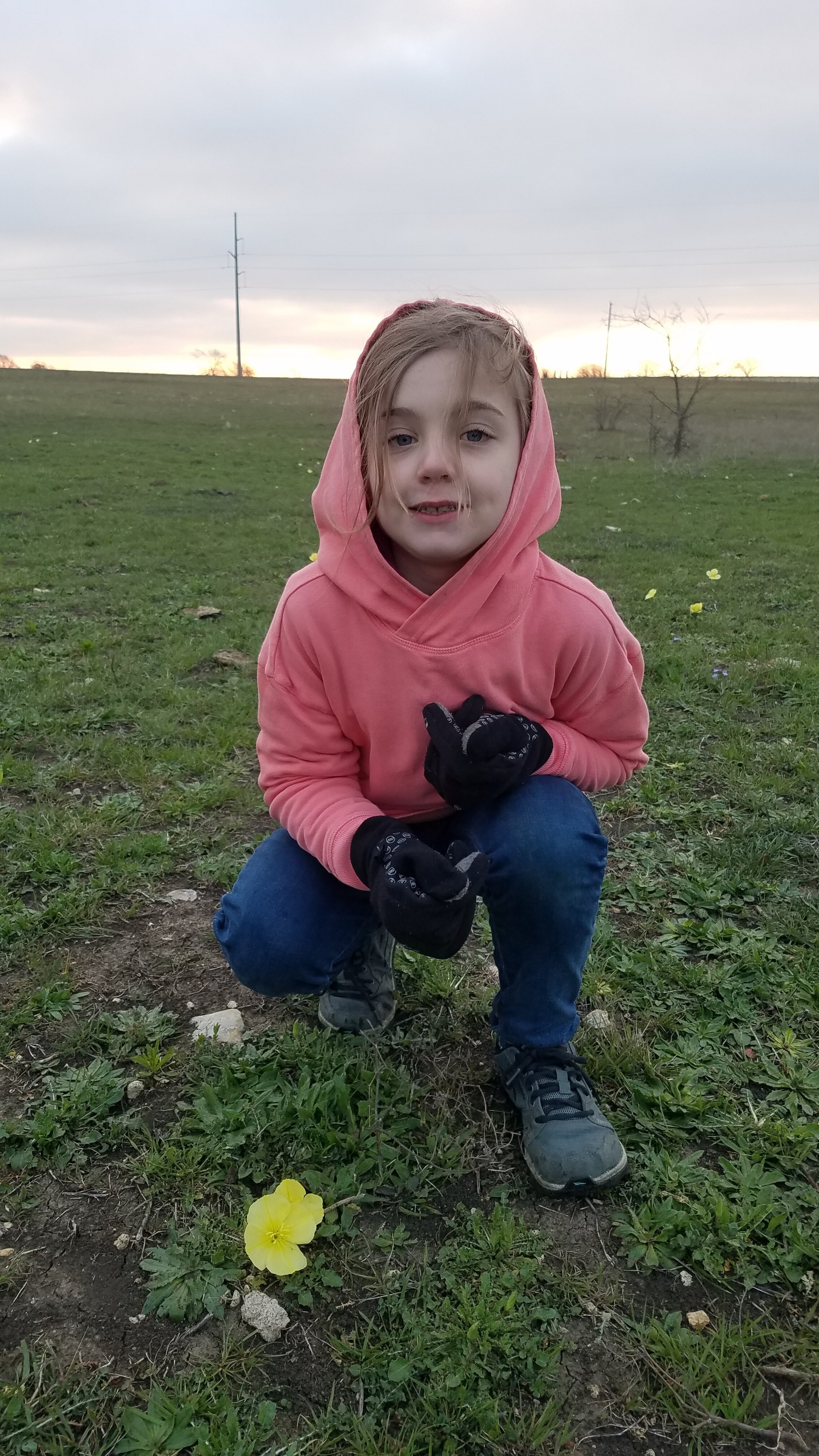
Every trip is different, and this trip could be more aptly named “Cows and Climbing” Weekend! In late March, three six-year-old girls and their dads braved a chilly Texas spring to rough it and climb it. On Friday we pitched camp on former cotton field reverted to prairieland on private ranch to avoid the spring break crowds at the nearby State Parks. No bathrooms, just a hole in the ground! Then we went hiking and fishing at nearby Cleburne State Park. The views, as always, were amazing, with canyon walls and fossils underfoot. We returned to our campsite at dusk and fell asleep to the mellifluous sound of oil rig pumps in the distance providing white noise. Then, in the middle of the night, MOOO! MOOO! a herd of cows walked right through our campsite, lowing right next to the tents. Like, inches from the tent walls. They did this for about an eternity (half hour) before moving on.

Beside the truck you can see the spring flowers and behind them, our tents.

Beside the truck you can see the spring flowers and behind them, our tents.

The next morning, we realized some cows and calves had been separated from the herd outside the fence, and a rancher came out and asked us to help chase them back in. Already cowgirls and cowboys, we added horses to the equation by driving over to the close-by Dinosaur Valley State park. There we had an hourlong horseback ride up the ridgeline overlooking the beautiful Paluxy River, home the first dinosaur trackway discovered in the United States. We also started changing our focus to climbing, with a steep scramble on all fours up a different ridge to an overlook above the river valley.

Taking in the views of the hills that form the Denio Creek watershed.

Taking in the views of the hills that form the Denio Creek watershed.

Then we drove over to Hico, Texas, to climb a trio of historic grain silos converted to an outdoor rock climbing gym. There we alternated between climbing the silos and challenging ourselves on the outdoor American Ninja Warrior set and zipline handcrafted by Dave Bradley, the owner of the silos, former shop teacher, and a ninja in his own right. Climbing the silos is part of the Texas Wild West’s “Introduction to Outdoor Climbing” course, which can be done as a single day trip from Dallas. We, however, we spreading the course out over the weekend. The silo walls are studded with the colorful handholds and jugs you would see in a traditional indoor climbing gym; however, they are outside. Being forty feet high, with the wind in your ears and birdseye perspective gained solely through self-powered ascent is a formative experience and soft introduction to climbing actual outdoor rock, planned for the next day. When we had had our fill ninjatime, we headed back to our campsites. On the way, we stopped for a picnic dinner at an overlook on Chalk Mountain where all of the Texas lowlands spread out beneath us in a patchwork whole.

The next day dawned cold and windy. Our girls braved it long enough to have a contest of collecting cow bones strewn all over the overgrazed ranch. From bleached skulls to femurs, they shouted and competed to find the most. The former bovine body parts did not seem not phase them at all. After we counted the winnings, we read the story of Ezekiel’s prophecy to the valley of the dry bones. It was a fitting end to winter and the beginning of flourishing spring. Then we bid farewell to our campsite, put sod over our toilet hole, and drove over to a steep river valley cut by the Nolan River. Here we put makeshift climbing helmets (bicycle helmets) on our girls and took them bouldering. After some truly picturesque panoramas from atop boulders we scaled in the river, we got sidetracked with hunting fossils which are in abundance along the river’s edge. Finally we climbed a pure rock climbing route (5.7) on the Chuck Norris wall and (if you’ll pardon the pun) ended our trip on a high note.

Fourwheeling Adventure in the Pineywoods!

We are pleased to announce a new adventure package: Treads and Wires! Your mission is fourwheeling through East Texas pineywoods followed by high-adventure ziplining from a scenic overlook. This is an awesome adventure experience that can be done as a day trip or an overnight, with access to a lake full of fish, sunsets, and wildlife. Only a ninety minute drive from Dallas, you’ll be amazed at the lofty pines, the fresh air, and the deer in abundance. We have three 2-seat four wheelers and three single-seat four wheelers. Book a trip with your buddies, your family, or your coworkers, you’ll have a time you’ll be talking about for a long time.

Ziplining in East Texas:  an adventure for a family, buddies, or coworkers!

Ziplining in East Texas: an adventure for a family, buddies, or coworkers!

A confidence builder for kids of all ages!

A confidence builder for kids of all ages!

The bird’s eye view…..

The bird’s eye view…..

will have you kissing the ground as well!

will have you kissing the ground as well!

Guide to Outdoor Rock Climbing: the Insect Lifecycle

Outdoor rock climbing roughly follows butterfly gestation. Here’s my rough guide to outdoor rock climbing and associated gear.

Sizing up the grip.jpg

Caterpillar Phase

Welcome out of the egg! You have just arrived and are staring at the cliff. There are typically two reactions. In the first one, it looks impossible. It’s the Cliffs of Insanity! In the second one, it looks so easy. You just put your feet and hands there and then there and there! That’s it! So you move to the cliff face, put your hands at the start, and …. nothing happens. You can’t even hold onto the handhold long enough to put your feet in the envisioned start. Your grand dreams pop. Patience grasshopper. I mean caterpillar.

The first few times out you will roughen and toughen your hands, back, and muscles you didn’t know you had. If you’ve been indoor climbing a few times, you’ll find outdoor climbing a different world, which it is. There are no pretty, preset handholds. You must make sense of the plethora or dearth of handholds out there which are variable quality. It can be a little bit of a shock compared to a cozy indoor climbing gym.

Equipment you need:

  • Rock climbing shoes

  • Safety harness

  • Bicycle helmet to serve as climbing helmet

  • Climbing friends who can provide guidance and necessary equipment

Chrysalis Phase

Ok, so you’ve been out a couple times and you think you like it! Your hands are a little stronger and the fingertips don’t feel rubbed raw at the end of a climbing session. It’s time to learn top roping, rappelling, and serious training. Experienced indoor climbers can leapfrog directly to this phase.

Over time you should accumulate the following equipment for your cocoon:

  • Climbing backpack

  • Bona fide climbing helmet

  • Approach shoes

  • Rope

  • Toprope webbing

  • Three autolocking carabiners

  • Two regular carabiners

  • Chalk bag

  • Belay Device (e.g. ATC)

  • Grigri

  • Bouldering crash pad

  • Hangboard and pegboard for your garage at home

  • Mountaineering emergency survival equipment

Butterfly Phase

After several years in your chrysalis, it’s time to take flight. The preparation in the cocoon will serve so that your flight will not be to the afterlife. You will now learn how to climb by yourself with a microcender, to lead climb, and to place anchors. You will need:

  • Microcender

  • A massive rack of lead climb carabiners and regular carabiners dangling from your harness

  • Longer rope

  • Pneumatic drill

  • Bolt kit

  • Off-road capable vehicle for getting to the climbing walls

  • Your own style of climbing

On top 2.jpg

December 2020 Peakingbagging Expedition in the Big Bend Ranch

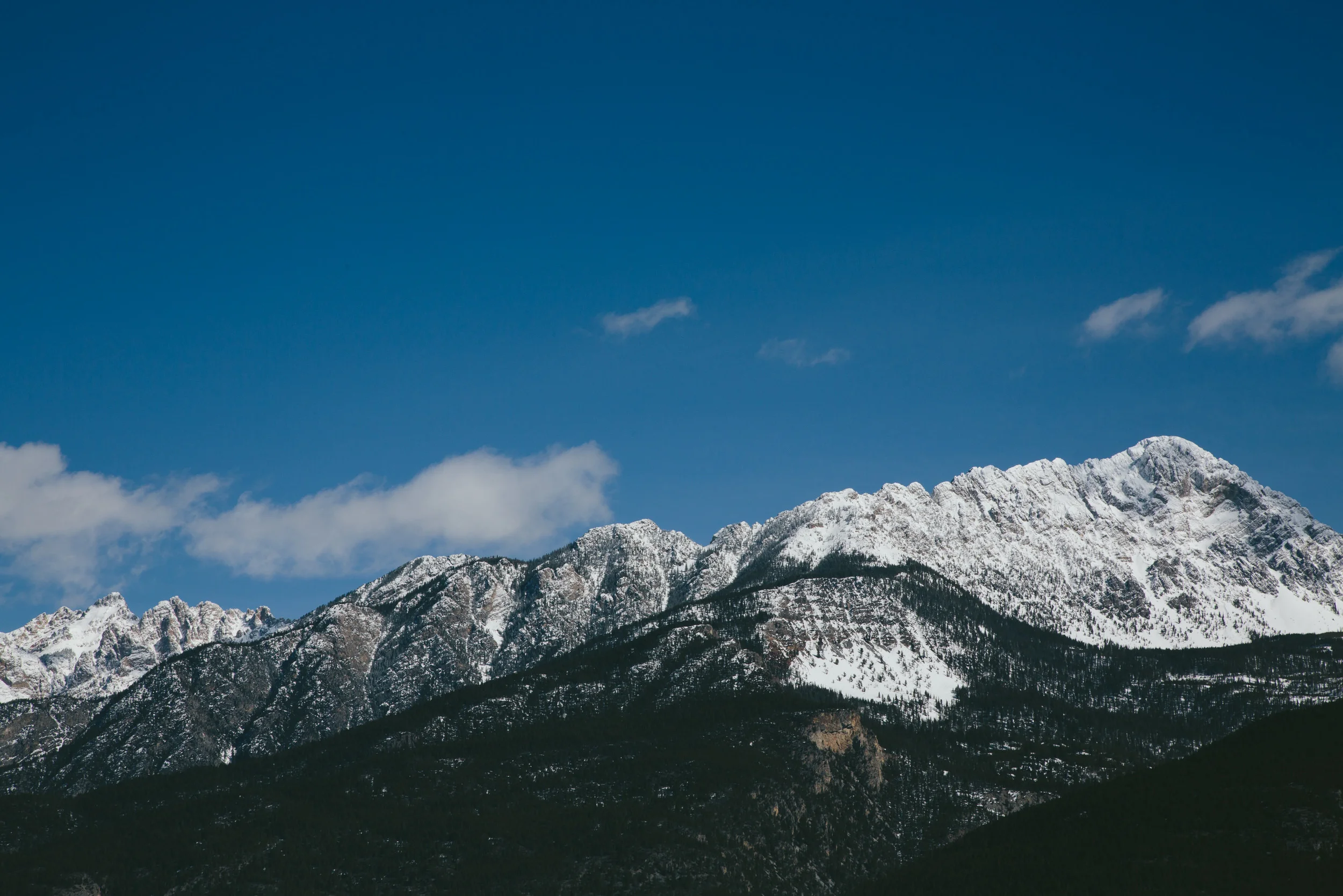
We team of three mountaineers, Barry Raven, Jefe (true name withheld), and I conducted a successful trip in the 311,000-acre state park on the Rio Grande. As a team we successfully bagged three of four attempted peaks: Solitario Peak, the Needle, and Agua Adentro. The fourth, La Mota, was successfully summitted by Barry although Jefe and I did not summit out of concern for the poor quality handholds on the crumbling and fractured rock. After these four peaks, none of which required technical climbing gear except climbing helmets, I soloed two additional peaks in the Llano Dome highlands. The trip consisted of five nights out with a day’s drive on either side and an epic snowstorm that dumped rain and five inches of snow on the Chihuahuan Desert.

EpicAdventureInBigBend.jpg

Solitario Peak, also known as Fierro (Spanish for Iron) Peak juts out of the center north of the Solitario, which is the crater and surrounding “flatiron” mountains of an ancient volcano. The Solitario used to be flat seafloor until 78 million years ago a massive eruption ripped through the seafloor and pushed out ripple-like mountains around a massive crater, which is visible from space and can be seen in Google Maps. Theses mountains have a smooth slope on one side and a steep cliffs on the other resembling irons, hence the geologic moniker “flatirons.” Solitario Peak, on the other hand, looks nothing like this, but instead rears out of the otherwise flat central volcanic basin like a jaggedly toothed fan of sharp rock, leading us to speculate that it was a volcanic plug. We circumnavigated the peak and used our best judgment to determine the best way to the top. We decided on a gully close to the summit, and charged up it. A hundred feet from the summit (although we couldn’t tell yet that it was the summit), the gully turned to Class 4 exposed rock, part of which was through a tree and all of which was slightly uncomfortably “exposed” in mountaineering lingo, meaning a drop from a height would be severe. But the handholds where plentiful and solid and we made it to the top from which the views of the entire basin were terrific. Mindful of the descent, we spent only 15 minutes on the top, but descent was actually not as bad the ascent (which is usually not the case). On the way down, Barry and Jefe espied a different route to the top consisting of a catwalk that could be further explored.

Outline of Solitario Peak.JPG

The next day, we attempted The Needle. The Needle is a definite volcanic plug that rises like a single-toothed spire from the southern end of the basin, four miles south of Solitario Peak. This time, we had to hike almost four miles until we reached the base, and then the circumlocution of The Needle was considerably more arduous than the previous day owing to the rough terrain. The Needle was a gnarly mess of extremely technical (viz., requiring serious rock climbing gear of ropes harnesses, and bolts) and “bad,” i.e., crumbly, rock. However, Barry espied a solid route up to a gully that led to the top. I led the route up the rock face to the gully from whence we were home free. Again, the views from the top were amazing, affording views deep into Mexico’s Sierra Rica range and even the Chinati Mountains to the west. Santiago, another volcano but with its mountain walls intact, was also visible to the north. We lingered at the summit due to the earlier arrival than at Solitario Peak, and I discovered an easier descent on the northeast side of the mountains. That night, back at camp, we had a victory dinner of venison, a buck that I had shot a week earlier. We encamped on an overlook three miles away from the Solitario from whence we could see most of the Solitario’s peaks, with Solitario Peak’s serrated edges visible above the surrounding flatirons.

Hickory-smoked venison victory dinner overlooking the Solitario mountains.  Note Solitario Peak sticking out like a sore thumb in the upper right of the range.

Hickory-smoked venison victory dinner overlooking the Solitario mountains. Note Solitario Peak sticking out like a sore thumb in the upper right of the range.

The third day took us to a completely different part of the park, away from the Solitario, to the Llano uplift to the west. There we attempted La Mota mountain, which rises like a curved, upward sloping aircraft carrier 900 feet above the surrounding high plains. A wall of cliff, in some places a hundred feet high, ringed the summit. We scaled to the base of the cliffs and sought a chink in the armor. Barry found a thirty-foot Class Four break in the cliff face, but Jefe and I did not feel sufficiently comfortable in the weak and fractured rock to pass ourselves. I had to pound each handhold with my fist before committing my weight to it, and I was glad of this precaution for seemingly stable holds would vibrate or shift altogether. Jefe said that he’d seen this type of rock before, where entire blocks would suddenly shift outward from the novel weight of a climber, squishing the climber as it did so. Thus we proceeded with extreme caution and maintaining three points of contact with the rock at all times. Although Barry made it to the top of the cliff, he didn’t look like he wanted to descend the same route. He departed to claim the summit and to look for another way down, which he did. Jefe and I made our leisurely way down the mountain and back to camp where Barry intercepted us with news of a different route down (and up) along the east face (the prow of the aircraft carrier) that was a complete break in the cliff.

The fourth day we attempted Agua Adentro peak, one of the tallest and most striking mountains in the park. Meaning “Water Inside,” Agua Adentro has a spring at its base that supports diverse wildlife and a grove of majestic alamos, or cottonwood trees. From the base we spied a gully directly leading to the ridgeline and from thence a clean walk to the summit. We had seen the back of Agua Adentro from La Mota the day before and knew that the back did not have the ring of cliffs that the front did. Our assessment proved correct, and we made the summit in an hour and a half. The view was the most spectacular yet, with views deep into Mexico and almost all of the peaks within the park laid out before us. To the west, however, we could see the approaching cold front and departed before it hit. Upon return, we parted ways, Barry and Jefe to a hotel in Alpine and me to a campsite on the Llano Plateau.

View to the east from the summit of Agua Adentro.

View to the east from the summit of Agua Adentro.

View to the west from the summit of Agua Adentro.

View to the west from the summit of Agua Adentro.

As I drove to the campsite, it began to rain. The rainfall increased as I approached the site. I noticed that the neverending expanse of creosote bushes were dropping their pungent leaves in expectation of the foliage renewal made possible by the precipitation. I set up my tent in heavy rain, and as soon as the tent was up, the rain stopped (of course). A heavy west wind sprang up as I surveyed the area and the map, and I decided to attempt a summit of a nearby unnamed peak at 4,563 feet. From it I could see Ojo Mexicano, a spring of water with stately alamos in fall colors around it. On the way back to the campsite, I summited a lesser peak and as I approached “home,” the snow began to start in earnest. I was amazed to see it start to stick to the ground and realized how the rain and subsequent wind had sufficiently cooled the earth. The dropping temperatures allowed the snow to stick to even me.

I had a pleasant dinner in my campsite, and enjoyed the break from the incandescent full moon from the previous three nights. I also quite enjoyed the cooler weather after the seventy- and eighty-degrees of the past four days. It fell to 22 degrees that night. At first I slept well but awoke to the walls of the tent bulging in on me under the weight of the snow. I pushed, punched, and kicked the snow off the walls of the tent sufficiently to resume slumber but a small worry formed as to how I would return through snow or mud in a light SUV.

As it turned out, I had no need to worry. My Honda Pilot was sufficient to handle the five inches and bad road, and views of mountains in the snow reminded me of my travels in Sweden. On the way out of the park, I drove past Agua Adentro, now wreathed in dignified white mist and glory. A fitting end to an epic adventure.

Agua Adentro in snow.jpg
Snowy wall and tree.jpg

Fine-Tuning Your Pack: Mountaineering Edition

We all want to buy our equipment once and have it work for all—or at least most—cases. But while we all desire our equipment to be versatile, there is something to be said for specialization. Not all things in your pack need be specialized, but the more you have that is, the more the chances of success—and even of survival.

Last month, I went to climb a couple of 12,000-foot peaks. A successful mountaineer’s motto is: “Go light, go fast.” Speed is crucial because thunderstorms build during the late morning and unleash electrical fury in the mid-afternoon on bare, exposed mountaintops above the treeline where there is no shelter. One of my climbing buddies has actually been struck by lightening. One must also account for the possibility of being stuck on the mountain overnight due to injury or getting lost. Without further ado, here is a conservative mountaineer’s pack:

Top “Twenty” for the Mountaineer

1) The pack itself—keep it light!
2) Water—since the mountains tend to be cooler, less water is needed, especially if there are streams. About two liters of water is sufficient unless you are hiking the Big Bend.
3) Water Purifier: I use a Katadyn water filter as they are reliable
4) Compass
5) Headlamp (with extra batteries if needed). Think light. I’m about to buy myself a 3 ounce Black Diamond Spot 325 over some of the other 4 ounce models to shave down that one ounce. My current monstrosity is a 13.5 ounce Cobit—far too heavy. Although it doubles the weight, bring extra batteries (bearing in mind that 3 AAA batteries weigh just under 3 oz).
6) Knife. Heavier hunting knives are not needed unless hunting. Make it a pocketknife.
7) Lighter or matches
8) Goretex rain jacket with hood and Goretex pants for the inevitable rain or hailstorm
9) Gloves and hat. If using an ice ax, make sure that the gloves provide sufficient protection over the knuckles.
10) Map
11) PLB or satellite phone
12) Emergency bivy sack (5 oz or less). It won’t be warm enough to sleep in it, but it will be warm enough that you won’t freeze to death if caught on the mountain overnight.
13) 40 gallon plastic garbage bag in which to put your pack during a heavy downpour
14) Down jacket (again, think light!). In order to keep it lightweight yet warm, use 800 or 900 down. This is more expensive, but the weight savings will be worth it. Down loses its warmth when wet although Primaloft has come up with a new synthetic down that does not. Regardless, this needs to be paired with the Goretex rain jacket above when it is precipitating.
15) First aid kit
16) Sunglasses
17) Change of clothes
18) Salt for electrolytes
19) Ice ax
20) Crampons—prefer steel because while heavier than aluminum or titanium, they are better for dirty climbing (i.e., on mixed rock/dirt/snow) that is more common here in the Southwest.

The last two are usually not necessary in summer. Some people take a look at this list and don’t take all—or even most of these. With lighter packs, they go even faster and further. But with these light packs come increased risk of death should something go wrong.

A photo of my pack. It is a pack with technology out of the 2000s, and I have since upgraded a number of things, starting with the pack itself, which is now 1.7 lbs rather than the 3 pound pack pictured. But you have to start somewhere!

A photo of my pack. It is a pack with technology out of the 2000s, and I have since upgraded a number of things, starting with the pack itself, which is now 1.7 lbs rather than the 3 pound pack pictured. But you have to start somewhere!

Deception Peak, New Mexico

Deception Peak, New Mexico

Our Posse Storms the Bend

I had the privilege of guiding a party of seven last weekend in the beautiful Colorado Bend wilderness in late May. Five of the seven were boys ranging from 6 to 9 years old. I’d taken these boys out before, and it was time to up their game. They rose to the challenge.

The troops gather on a dusty street in Hico, Texas….

The troops gather on a dusty street in Hico, Texas….

From Dallas, we drove ninety minutes to Siloville Rock Climbing Gym, a gem in Hico. Dave and Kathy have converted four historic grain silos into rock climbing walls, both inside and outside. Unfortunately, coronavirus regulation restricted us to climbing only the outside walls, but that was plenty. As one of the adults said, “I’ve been to indoor climbing gyms before, but to climb high, feel the wind and hear it in your ears, and look down to see how high you are is a different experience. After I looked down once, I decided not to look down again.” The view from the top, however, is spectacularly scenic and surprisingly relaxing.

Almost at Top.jpg
At top with perspective.jpg

From there, we drove to Colorado Bend State Park, where we hiked the three-mile round trip to Gorman Falls, the tallest, continuously flowing waterfall in Texas. The tufa, coral-like sheets of calcium as fine as lace depositing out of the water as the water turns to spray, was much in evidence. We could see rainbows in the waterfall too, although they were hard to capture on camera.

tufa2.jpg
Rainbox.jpg

The next day we canoed down the Colorado. Here the river alternates between rapids and consecutively deeper pools, flowing northeast until it slams into a cliff wall and then turns southeast in a dramatic curve that gives the area of Colorado Bend its name. During the trip, we noticed fins sticking out of the rapids. Closer inspection showed massive white bass, two to three feet long and between five and ten pounds hovering in the rapids in their annual mating run up the Colorado, analogous to the salmon of the Northwest. The depth of the water was insufficient to cover their entire bodies. The spectacle was moving for the shear number and size of the fish. One of the youngsters almost succeeded in clubbing one of them. Also amazing was the sight on one of the high banks of the river of a quintessential cowboy, replete with cowboy hat and firearm on his side, riding a unicycle. This latter vision prompted me to say, “I’ve seen it all.” Unfortunately, I have no photographic evidence but only the eyewitness of one of the other adults in the group who also saw the cowboy on his unusual steed.

Kayak.jpg
Restday2.jpg

The last day was a recovery one in which we went fishing and enjoyed burgers at the (only) store in Bend. A full weekend with a good crew.

Moses+w+fish.jpg
A raptor soars lazily above the cliffs of the Colorado Bend.

A raptor soars lazily above the cliffs of the Colorado Bend.